Developing Contour Understanding
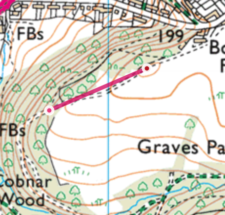
That leg was a bit more tricky as we start to explore some more subtle features of the map. As you look at the map, you will now see two paths, one stays level with a contour on the left and goes into the woods, whilst the other crosses a contour and leaves the woods into open space. We're going to take this path and rise up to the fields at the top of the hill. As we do, note the shape of the contour itself and have a think as to what you may expect that to look like as you walk up the path. In this instance, it represnts the land falling away on each side of the path, which means that you are walking up a really really broad ridge - to the top of a hill! The circular contour represents the top of the hill, which is todays mini mountain summit.
Stop when you get to the top of the little hill a few hundered metres from leaving the woods.
-
Fort St James
-
1. Bienvenue
-
2. Mât
-
3. Entrepôt Général et Magasin de Fourrures
-
4. Cache à Poisson
-
5. Maison des Employès
-
7. Jardin
-
8. Magasin
-
6. La Maison de l'Interprète
-
9. A) Résidence de l'officier
-
9. B) Résidence de l'officier