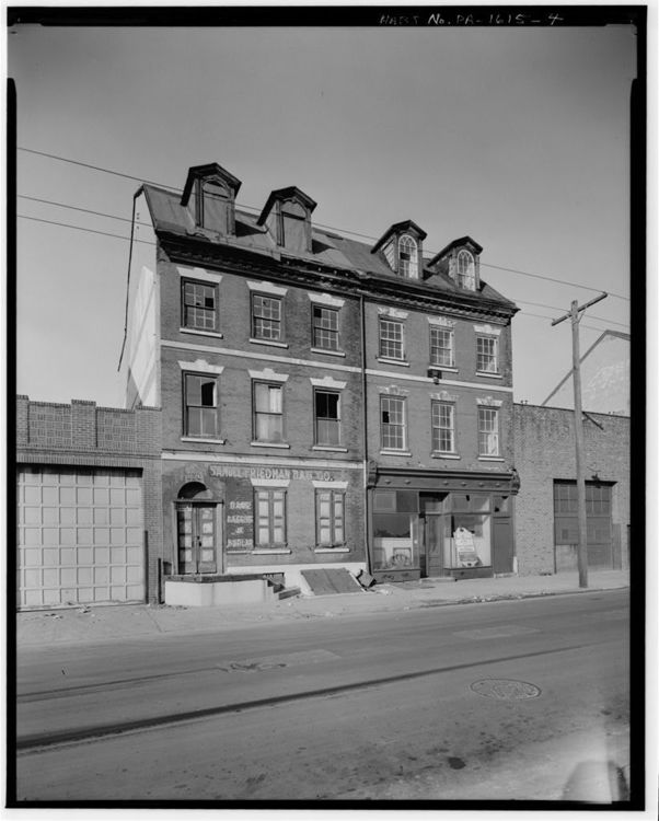
Samuel & Joseph Reed Houses (518-520 S Front St)
We begin our tour on the eastern edge of the neighborhood, where the development of Philadelphia first began. As Margaret Tinkcom has discussed, these buildings were documented by HABS and physically preserved, even as the construction of Interstate 95 destroyed virtually all buildings located to their east. Note how they have changed, however, from mixed use to residential today.
Further Reading:
Tinkcom, Margaret B. “Southwark, A River Community: Its Shape and Substance.” Proceedings of the American Philosophical Society 114, no. 4 (August 1970): 327-342. https://www-jstor-org.proxy.library.upenn.edu/stable/985956.
Kirkbride, Mrs. Earle R. “South Front Street Historic District.” February 28, 1972. https://catalog.archives.gov/id/71996918.
Kirkbride, Mrs. Earle R., and Patricia Siemiontkowski. “Southwark Historic District National Register Form.” March 14, 1972. https://gis.penndot.gov/CRGISAttachments/SiteResource/H001472_01H.pdf.
“Southwark Historic District National Register Inventory.” https://gis.penndot.gov/CRGISAttachments/SiteResource/H001472_1453_I.pdf.
Image Source: https://www.loc.gov/resource/hhh.pa0776.photos/?sp=4